Introduction
The Northern Sangres are comparatively smaller than their southerly neighbors and feature for the most part Class 2 talus hopping (endless).
But this segment is not a walk in the park. You’re still going to face over 12 contiguous miles over 12,000’ between Galena Peak and Simmons Peak on a riptide of sharp summits. Camping options are very thin. Methodist Mountain, the last peak we’ll cover in the range, will seem quite diminutive after all the peaks you’ve seen pass below your legs.
- 27.39 miles
- 9,384′ gain
- 12,997′ loss
Difficulty: Moderate — Class 1 trails and Class2+ bushwhacking and talus hopping, lack of water sources, difficulty bailing.
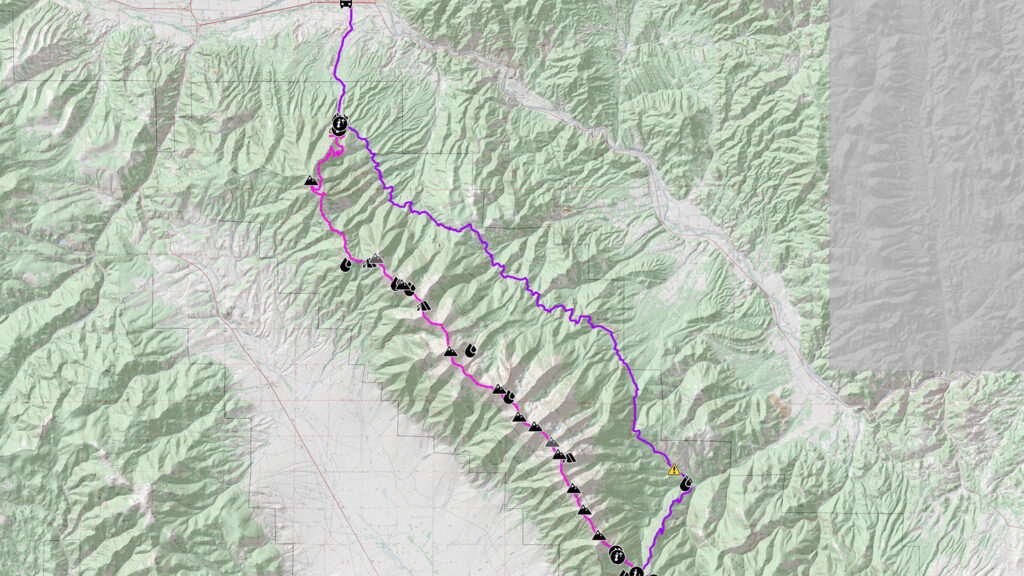
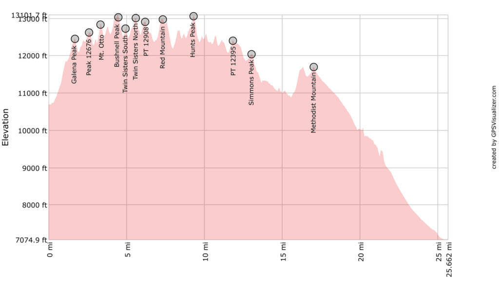
Peaks Summited
- Galena Peak, 12,478′
- Peak 12676, 12,676′
- Mt. Otto, 12,865′
- Bushnell Peak, 13,112′
- Twin Sisters, South, 12,741′
- Twin Sisters, North, 13009′
- Point 12908, 12,908′
- Red Mountain, 12,975
- Hunts Peak, 13,061′
- Point 12395, 12,395′
- Simmons Peak, 12,060′
- Methodist Mountain, 11,712′
Getting There
Hayden Pass can be traversed via 4WD from the east or west.
Narrative
A lifetime of adventure has already been passed in the last 90 miles, one more segment to go. Be sure to be fully loaded with water for perhaps the entire segment, as free running water is rarely available on route, except in late Spring. Any water you will require will need to be sourced off route or on any snow fields tenuously holding on.
0.0 Northwest of Hayden Pass, find the vestiges of an old mining road that starts on the other side of a fenced off area. Good camping options are found near this road. Leadville Limestone has now replaced the conglomerate you’ve been standing on since Mosca Pass. Follow this road as it makes its way steeply up the slope.
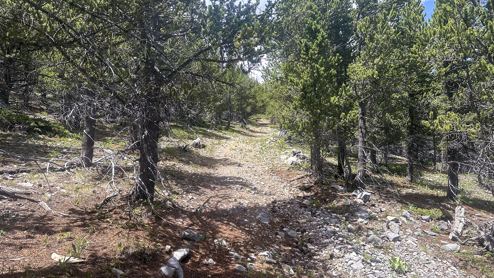
0.82 Find a social trail off the road marked by a double cairn and follow it up.
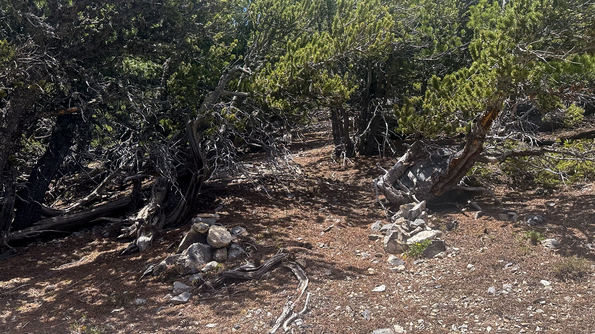
This trail generally follows the center line of the ridge, as it switchbacks up towards Galena Peak. You may lose it as the dusty grey rock of the ridgeline itself makes itself known. It may be easiest just to start scrambling on top of the ridge proper, rather than trying to follow the messy social trail full of ball-bearing like rocks just to the east of the ridge.
0.98 Social trail will peter out in rocks, then tundra.
As ever, follow the ridge ever farther up and dance your way to the summit of Galena.
1.70 Galena Peak
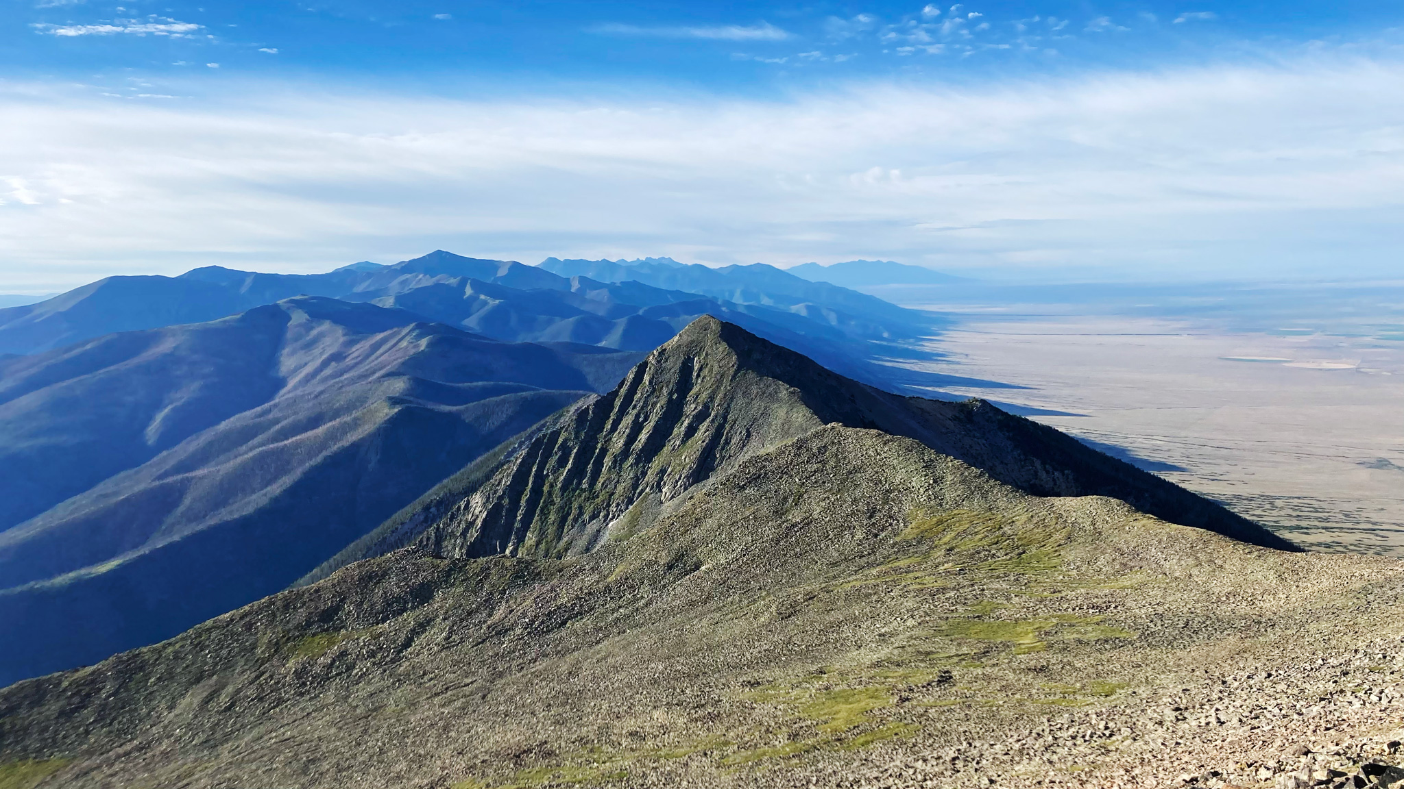
A long series of 12,000′-13,000′ peaks will now appear, all seemingly steeper than you may expect. The travel for these next peaks should be second nature to you now: continue on the ridge, picking off the summits as you find them. The first few peaks are devoid of lakes in their basins, so if you’re running out of water: well you were warned.
Bivying between Galena Peak and Peak 12401 is somewhat difficult, with some less than ideal options along the sharp talus. A relatively long expanse of flat area is found east of Bushnell Peak. The summit of PT 12401 is actually surrounded by a curious depression that could feasibly make a good bivy, protected from the wind. The ridgeline to the northwest has similar depressions. Snowfields could also be present, so you may also — or instead — be able to find water.
4.49 Bushnell Peak
Bailout: Between Bushnell and South Twin Sisters, carefully drop down the basin towards Bushnell Lakes and pick up the Bushnell Lakes Trail #1402 towards the Rainbow Trail.
4.94 South Twin Sisters
Bailout: Between South and North Twin Sisters, carefully drop down the basin towards Stout Creek Lakes. Pick up the Stout Creek Lakes Trail #1403 towards the Rainbow Trail.
7.31 Red Mountain
The slope below Red Mountain is less steep than the other slopes before it, and could give you easier time accessing water from West Creek Lake, east of the ridge. A spring could be found before the lake itself.
Bailout: Before Hunts Peak, drop down towards Hunt’s Lake, and take the Hunts Lakes Trail to the Rainbow Trail.
9.21 Hunts Peak
If at all possible, it’s suggested to push forward northwest as much as possible, past Simmons Peak, and below treeline, where bivvying options get altogether much better.
13.07 Tag Simmons peak and say goodbye to the alpine for the last time.
13.29 Below Simmons Peak and now below treeline, enter a burn area where the only trees you’ll find standing are the leftover trunks, either still attached to the ground or fallen onto their side. This whole area has an otherworldly feel to it, with new groves of aspens popping out, berry patches en mass, and beautiful wildflowers in abundance. Elk herds will dance in and out from a distance in the golden hours. You may even spot an errant cow that could be first mistaken as a enormous black bear, depending on lighting quality and your sleep deprivation. The southern end of the Sawatch Range can be seen in the distance as a perfect backdrop.
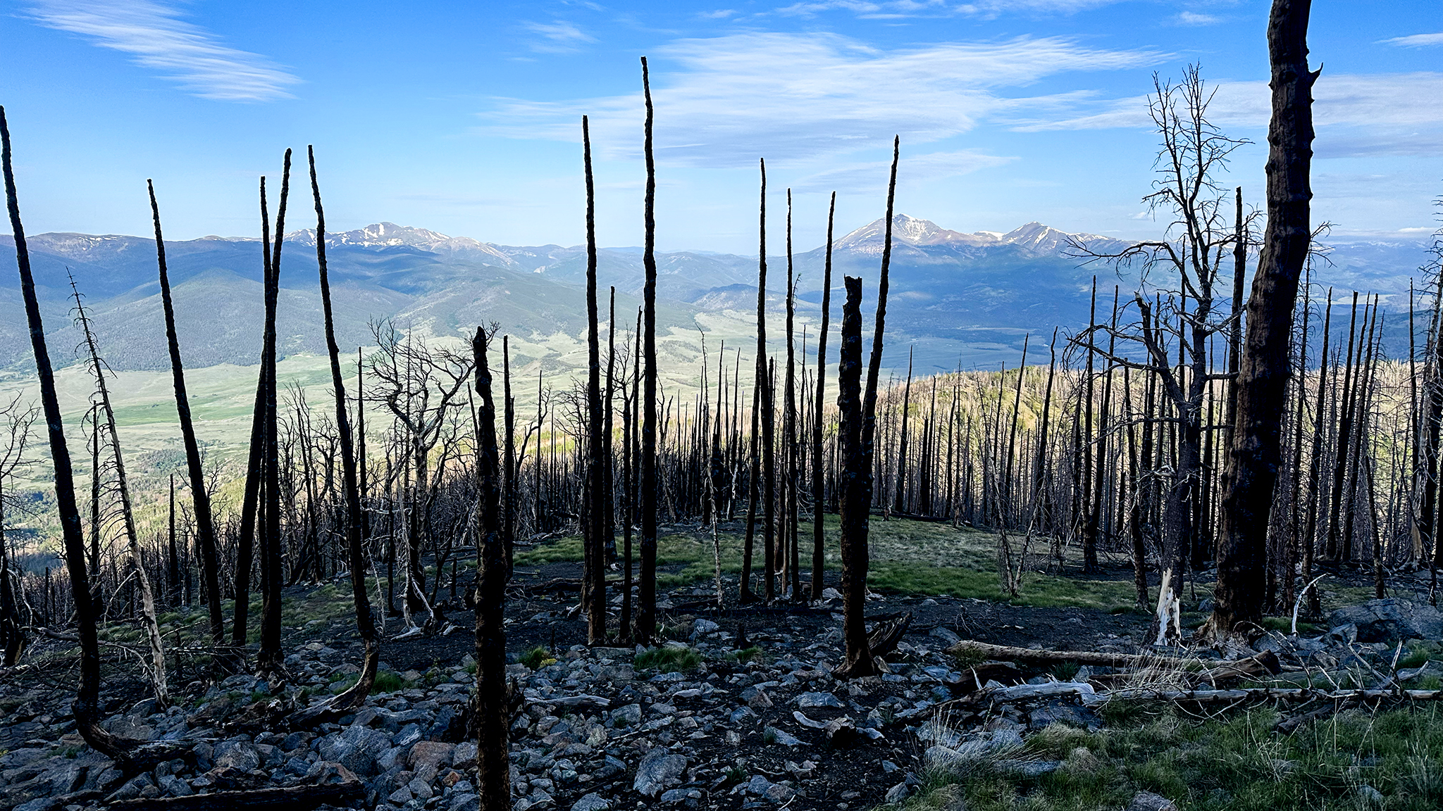
If water is urgent in this area, try Salamander lake on the west of the ridge, but it may simply be a mud pit.
This area used to be an almost never-ending maze of blowdown, enough to bring even the bravest man to tears — that’s how I found it in 2019. Now although there are some fallen tree trunks to step over, the going is relatively easy.
16.37 Make you way on the serpentine ridge as it lazily brings you to towards the summit of, “Communications Tower”. You’ll reach the service road, which you can take left to its summit.
Head cross country northwest towards the summit of Methodist Mountain, which also contains similar equipment.
17.03 The summit of Methodist Mountain is somewhat to the southeast of the man-made towers at a small cairn. Touch it to realize your final summit of the range.
The road down to Salida is over 8 miles – a burrito has never felt so far away! Descend down the road.
17.32 At the road junction, take the fork left heading north, descending.
The floor of the valley and Salida — civilization! — seems impossibly far away.
21.47 Near the Rainbow Trail Trailhead, there is some private property to skirt. Get off the road at the elbow of one switchback and bee-line it down the slope heading north — consult the map.
21.66 Rejoin the road, heading east.
22.07 Cross the Rainbow Trail, which may have water running on the west side care of Loggie Gulch.
23.49 CR 108 will soon turn to pavement with houses and ranches dotting up around you. If you’re in serious need of water, a ditch is available near the road on the east side, but hold out if you can.
25.16 Turn slightly left onto CR 107 and listen to the rush of traffic on Highway 50.
25.63 Reach the corner of CR 107 and HW 50 and the end of this route. This junction holds a hamburger joint and a convenience store. Revel in the fact that you have given yourself and your own blood to the Sangre de Cristo Range Traverse!