Introduction
This massive segment will take you from the San Luis Valley and the foot of the Sierra Blanca Massif, up and over three 14ers and one Centennial, and ends at Mosca Pass: the first pass accessible by a motor vehicle.
Some of the hardest technical cruxes are located in this segment including Little Bear’s Southwest Ridge, the Little Bear/Blanca Traverse, and Ellingwood’s North Ridge.
This segment is extremely committing.
- 23.17 miles
- 11232′ gain
- 9172′ loss
Difficulty: Extreme — Class 5 climbing, exposure, lack of water sources, lack of bivvy sites, blowdown, difficulty bailing.
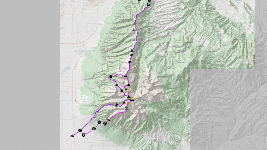
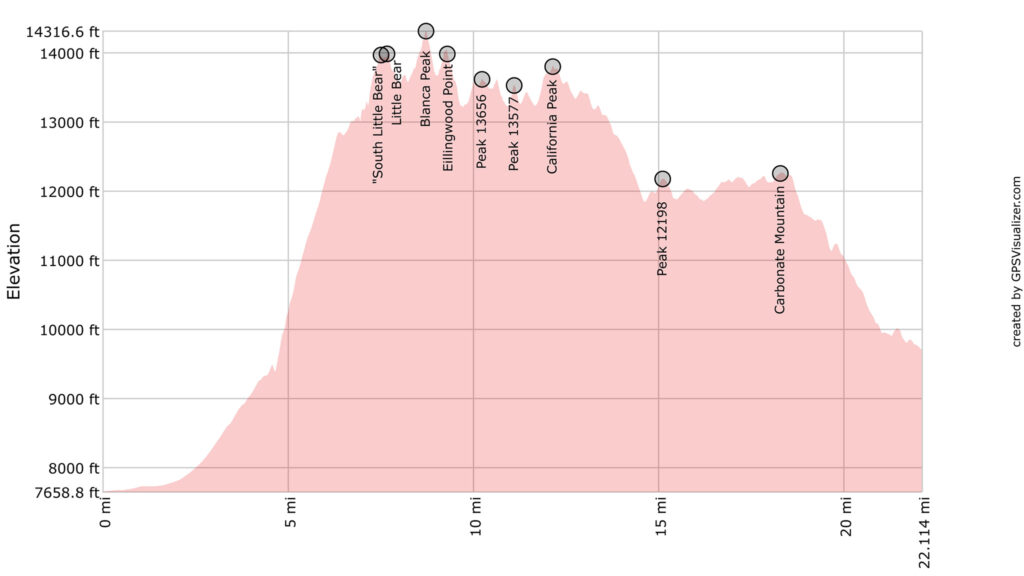
Peaks Summited:
- “South Little Bear”, 14,020′
- Little Bear Peak, 14,037′
- Blanca Peak, 14,345′
- Ellingwood Peak, 14042
- Peak 13656, 13,656′
- Peak 13577, 13,577′
- California Peak, 13,849′
- Peak 12198, 12,198′
- Carbonate Mountain, 12,313′
Getting There
The Lake Como Road Trailhead is right off CO-150 (paved) near Blanca CO and the Great Sand Dunes National Park. It’s a fairly popular trailhead, used by off-road enthusiasts for the reputation of the Lake Como Road itself, and by peak baggers, for the higher 14ers found after where the road ends.
We don’t suggest leaving a car for a week+ at the trailhead given this popularity, but rather for you/your party to be dropped off.
If you can find long-term parking in/near Salida, one suggestion is to travel to Alamosa via the Bustang Outrider service, then take the local taxi service from Alamosa to the Lake Como Road trailhead. Camp near the trailhead, or a little farther up the route, and start your traverse in earnest the next day.
Narrative
Start at Lake Como Road and CO State Highway 150. Dispersed camping is available along the road. The start of the route will be unlike any other segment, with cactus, low scrub and talcum powder-like sand making up the majority of the landscape. Highly modified off-road vehicles will most likely be present, used to tackle the Lake Como Road up to Lake Como. Tourists from Great Sand Dunes National Park stop at the info signs to take in the view of the Blanca Massif and wonder how realistic it is to make a half day out of a hike up Blanca Peak.
0.0 Follow the Lake Como Road NE until it intersects another unnamed road.
1.03 turn right heading SE on unnamed road.
1.62 Turn left heading NE onto a rougher 4WD road.
This whole area is full of 4WD roads that head NE and then dead end. Most are not mapped. These are old ranching and mining roads from another era, now used for recreational 4WD rides and hunting into the interior of the National Forest. Follow the GPX track/map provided closely for a route that attempts to take you to the start of the SW Ridge proper without dead-ending or running into the sharp branches of the local trees.
2.9 Enter the forest, then pass 24th and Poplar Streets on a NW corner (private property here and to the SE). Continue following the track heading NE.
3.85 The rough 4WD track you were following will end in a wash. Turn right and take this wash heading generally east.
4.42 A good albeit dry campsite will be crossed before you come to another 4WD track. This spot makes for the last good campsite before gaining the subsidiary ridge up to South Little Bear Peak. If you’re starting late in the afternoon, plan to stop here for a early morning assault up above treeline.
4.48 Turn left then briefly follow a 4WD track heading generally north.
4.5 Exit 4WD track heading northeast as it continues NW. A brief bushwhack will get you to Tobin Creek.
4.64 Cross Tobin Creek.
Camel up here, as this will be the last dependable free-flowing water source strictly on route until Medano Pass. Any water you may need will have to be found in snow fields or off-route.
Start up the SW Ridge route of Little Bear.
7.52 Summit South Little Bear (Class 4)
7.68 Summit Little Bear. There are many miles miles of technical scrambling to go.
Bailout on Little Bear: Descend via the Hourglass Route (Class 4). This is an easier way than the traverse over to Blanca, but is no walk in the park, with rock fall danger from climbers above you being your main concern. Communicate your presence and intentions to anyone you will be getting near.
Alternative Start via Lake Como/Little Bear Hourglass: from the start of Lake Como, continue on Lake Como Road to Lake Como where camping is available. Take the Hourglass Route to the summit of Little Bear (Class 4) and continue on the route from here.
Traverse over to Blanca Peak via the Little Bear/Blanca Traverse (Class 5). This is the first of two of Roach’s “Great 14er Traverses” and this route will connect these two traverses together. This traverse is one of the wildest and most incredible part of the entire traverse of the ridge of the Sangre de Cristos, but it’s only the first segment of your own trip!
This is your first test: can you safely do this traverse, with a heavy pack, and keep smiling? If this proves too difficult, know that there are miles more of similar terrain still to cover before you get to Salida — often with harder cruxes.
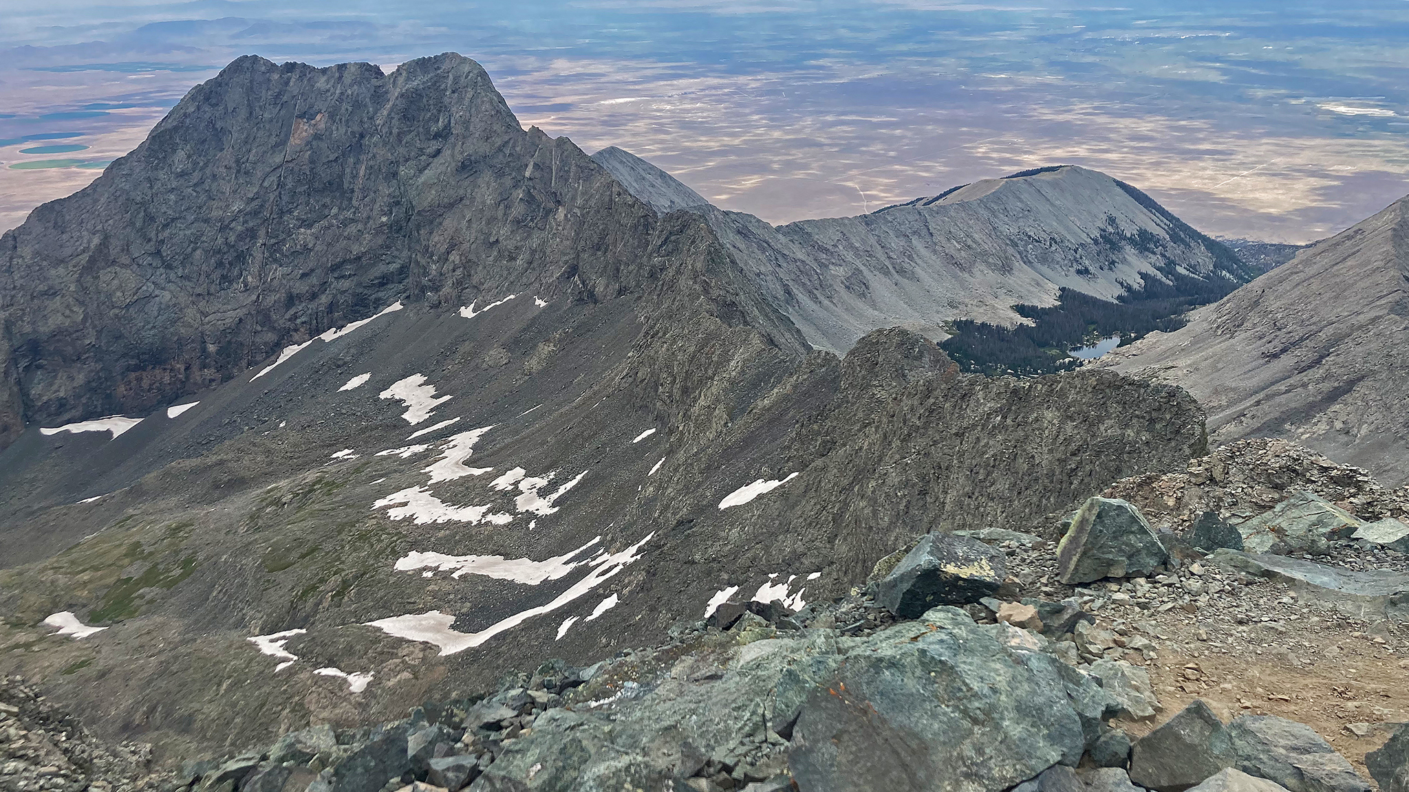
8.74 Summit Blanca Peak
The next summit will be Ellingwood Point. The direct ridge traverse to Ellingwood Point goes at approx. 5.4 (downclimb), but is relatively short. You can take a less direct route off the ridge by simply following the standard route off of Blanca Peak until it meets up with the standard route with Ellingwood Point, then take that trail to its summit. A semi-permanent snowfield is located near this trail junction which can be used as a water source.
Bailout: descend the standard route for Blanca/Ellingwood towards Lake Como Road. Bivvying near the trail is possible if weather is deteriorating.
9.28 Summit Ellingwood Point.
If weather is holding on Ellingwood Point, continue on the main ridge north.
9.52 Pass a ridge shooting to the west. Afterwards, you’ll encounter a cruxy downclimb in two pitches (4th, Low 5th). Take this downclimb with care as exposure here is extreme. This is one of the most sensational sections of the entire segment.
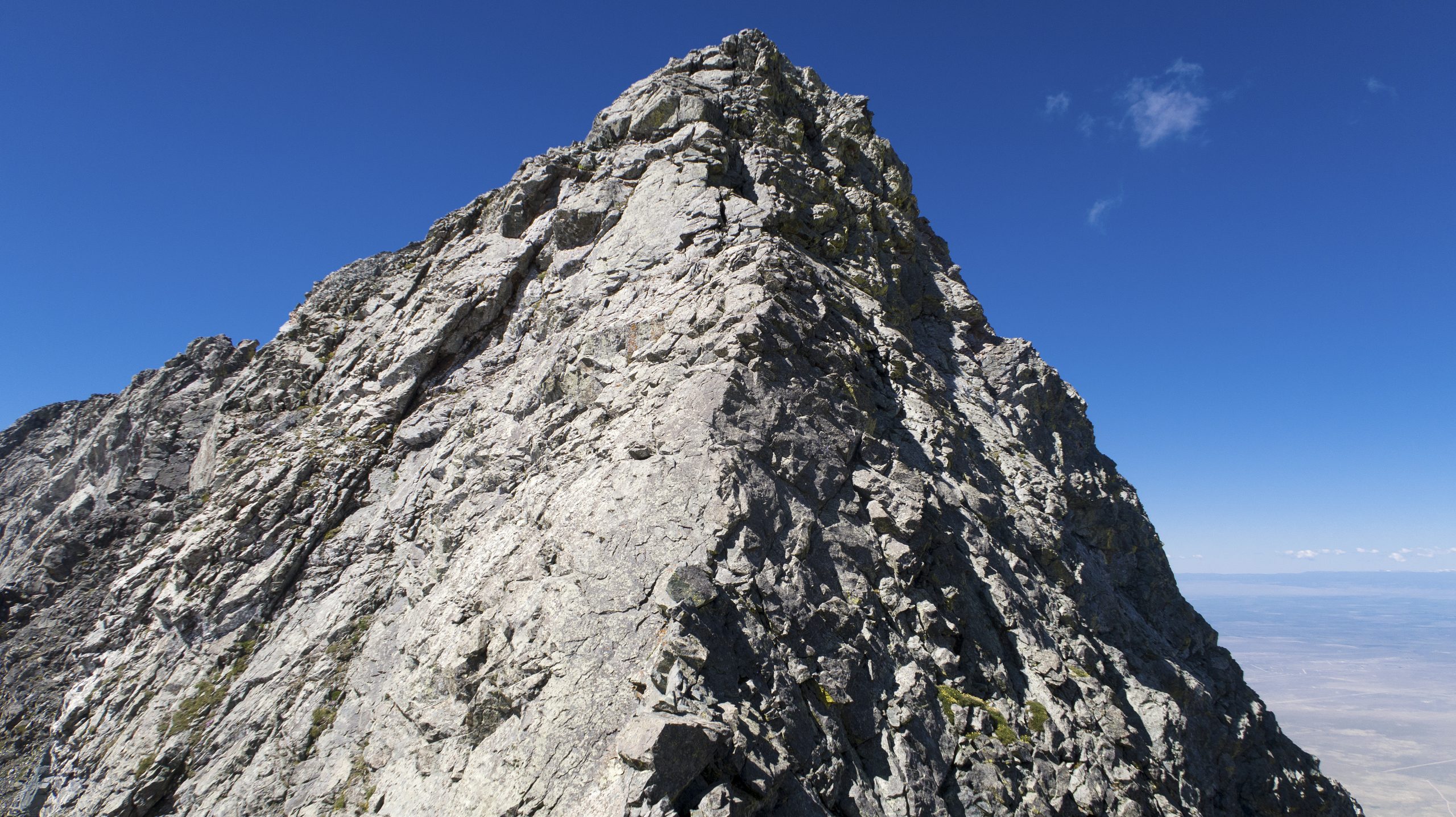
Once below these difficulties, breathe a sigh of relief, as the most difficult parts of the segment have been cleared. You still have many hours of Class 3 ridge scrambling before a reasonable bivy site is found. Collect yourself, and continue on the ridge over PT 13656, PT 13577, and California Peak.
12.16 Summit California Peak
Terrain north of California will generally be far easier, but you’ll still be above treeline for potentially a few hours more. Continue north on the ridge, generally talus hopping.
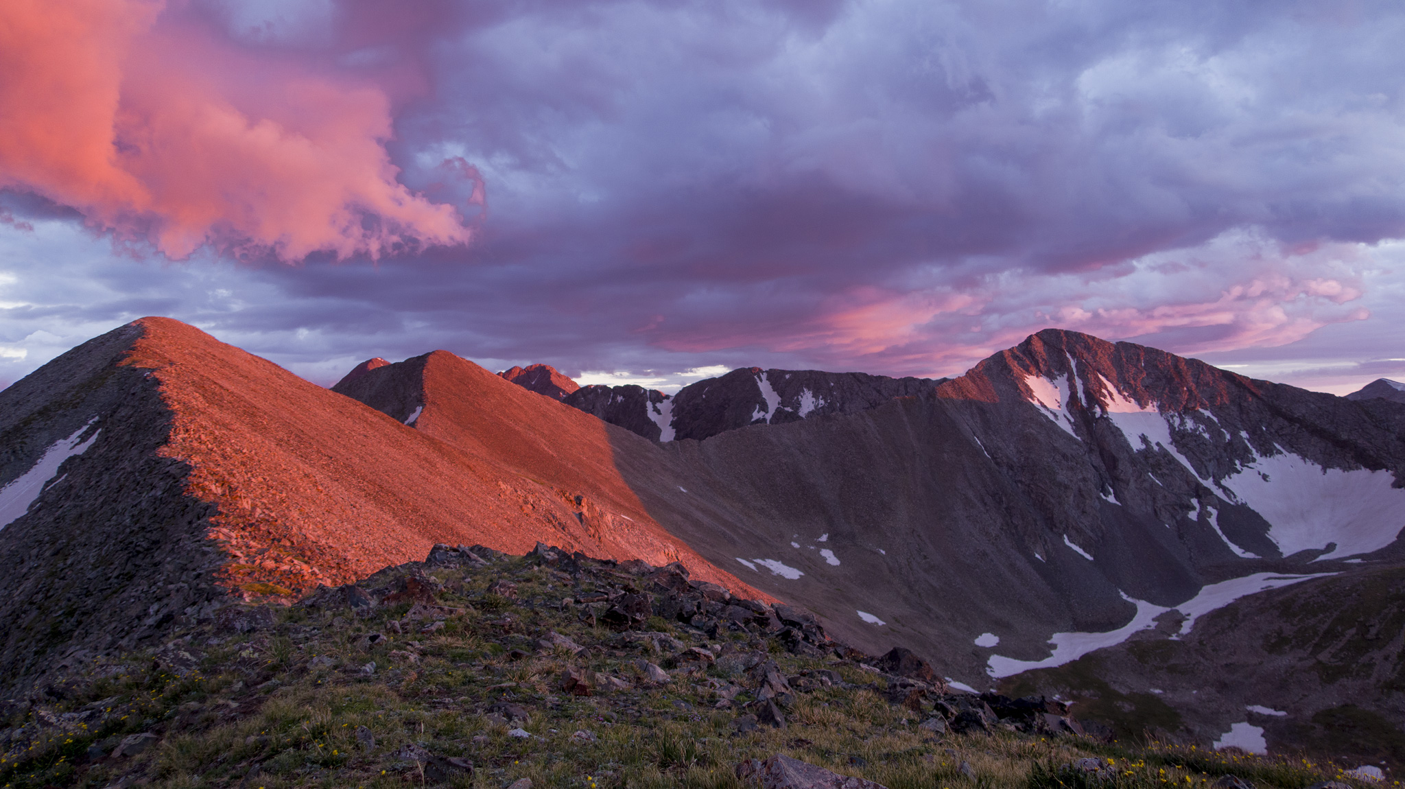
14.63 Cross over “Zapata Pass”. This point makes a marginal bivy.
Bailout: Taking the trail at “Zapata Pass” east, bringing you to the Huerfano/Lily Lake Trailhead. You are still many miles from a town, so prepare to hitch from here.
Roundtrip Idea: Taking the trail at “Zapata Pass” east to the Huerfano/Lily Lake Trailhead. Continue south on the trail and re-ascend Blanca Peak via Gash Ridge (low 5th). Descend Blanca Peak via its standard route, and descend down towards the highway via Lake Como Road. Gash Ridge is perhaps a little more difficult than the terrain found on the Little Bear/Blanca Traverse. This loop is extremely committing.
Alternative Start via Huerfano/Lily Lake Trailhead: Skip most of the Sierra Blanca by starting on the east side of the ridge at the Huerfano/Lily Lake Trailhead. Take the trail up to Zapata Pass to start your Odyssey north.
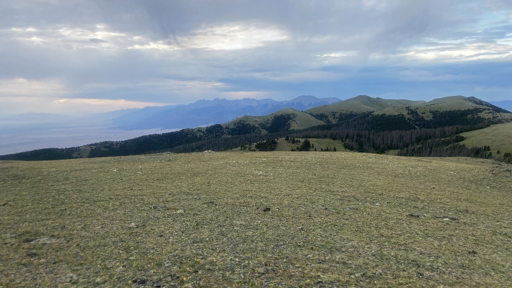
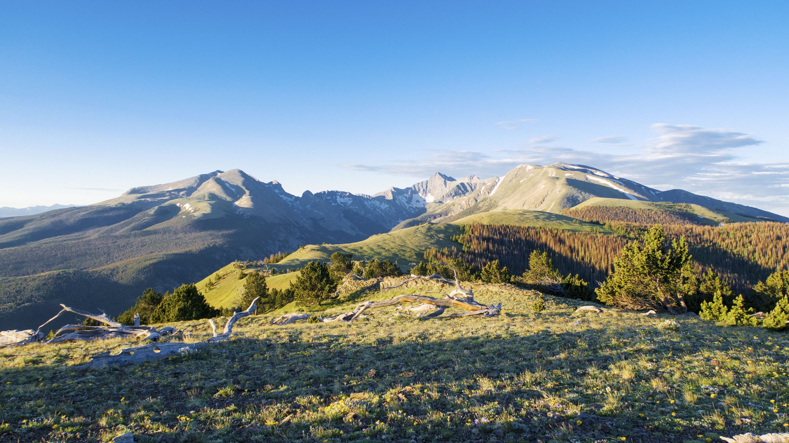
18.32 Carbonate Mountain. After Carbonate Mountain, you’ll eventually find a trail that will help you down through treeline, and to Mosca Pass.
Deadfall will be encountered on this trail – a small taste of things to come. Do your best to avoid it. The best way may be straight through in some instances.
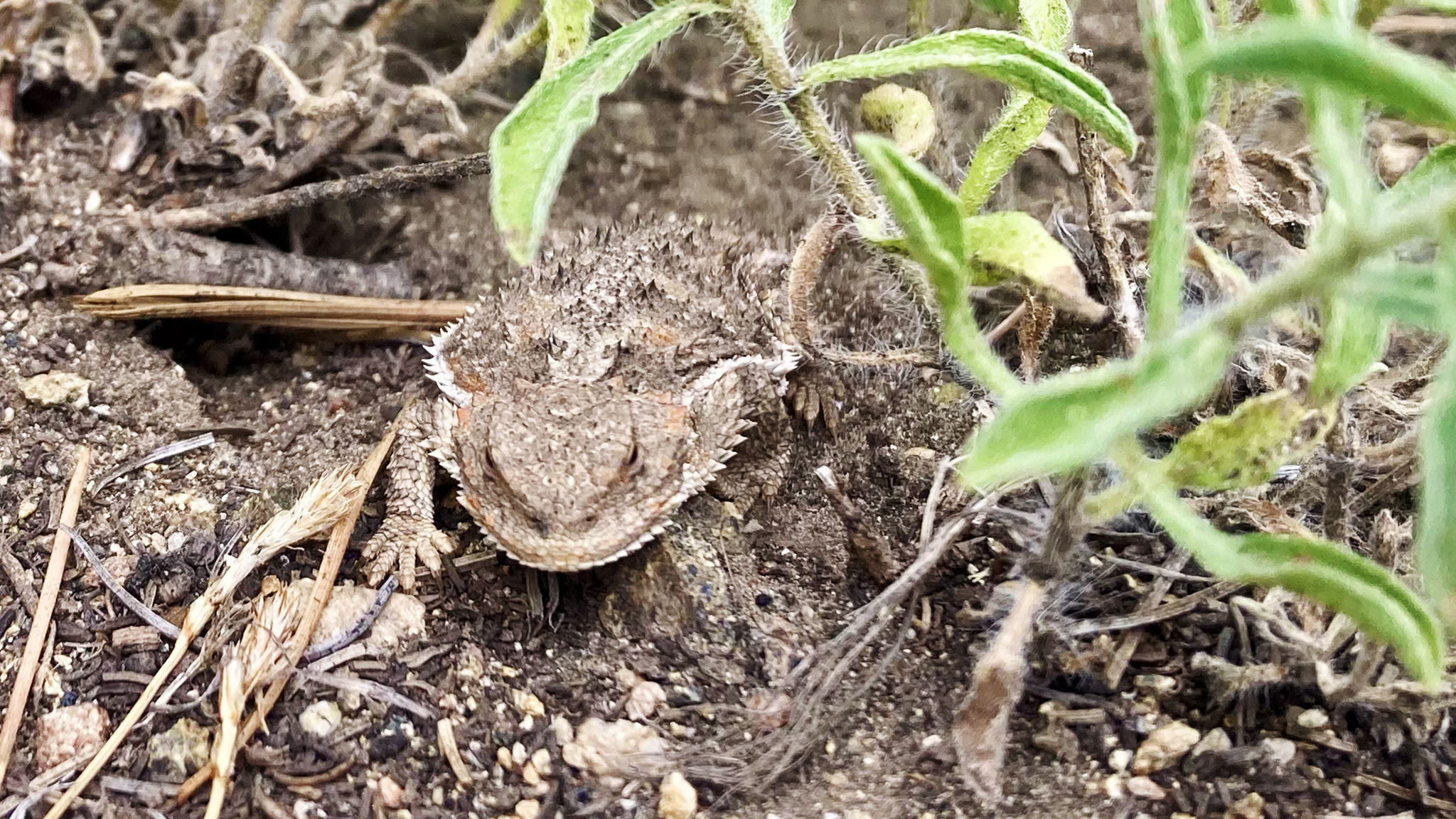
21.92 Eventually this trail will end at FS 583.A and shortly after that, Mosca Pass! A seasonal creek runs about a mile west off route if you are running low.
There are no water sources on the traverse over Mt. Zwischen – do not attempt to get to Medano Pass without an adequate amount of water.
Bailout: Mosca Pass is accessible via motor vehicle from the east where it will meet up with CO 69. Mosca Pass to the west is a footpath which will take you to the northeast point of the Great Sand Dunes National Park.